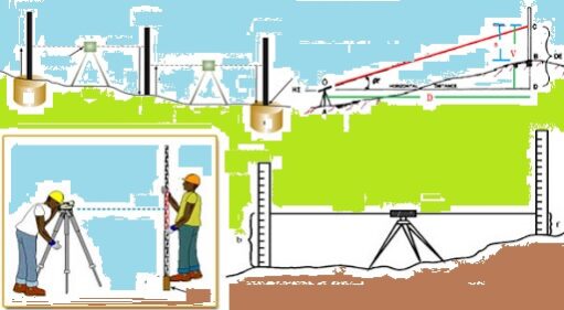
Surveying and levelling
Operation of making such measurements that the relative positions of various features, natural or artificial on the surface of the earth can be exhibited in their correct horizontal and vertical relationship.
Normally determining positions in the horizontal plane is called surveying and determining relative heights or depths is called levelling.
Division of Surveying:
Plane surveying
The earth surface is considered as plain surface, the curvature of the earth is ignored, a line joining any two stations is considered to be straight, the triangle formed by any three points is considered as plain, the angles of a triangle are considered as plain angles, carried out for a small area less than 250 km2
Geodetic surveying
The earth surface is considered as a curved surface, the curvature of the earth is taken into account, the line joining any two stations are considered as spherical, the triangle formed by any three points is considered as spherical angles, carried out for an area more than 250 km2.
Be the first to add a review.